jewel of pakistan
gilgit
baltistan
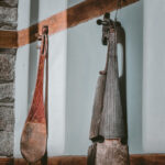
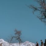
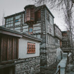
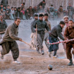
Gilgit Baltistan is a place where life is deeply rooted in culture and community. The strength of this land is reflected in its people who carry forward traditions with quiet pride and a sense of belonging that connects them to their valleys, rivers, and fields. Here, heritage is not preserved in museums but lived in daily practices of language, music, craft, and hospitality. Families share what they grow, artisans keep alive the wisdom of their ancestors, and gatherings under open skies remind everyone of the value of togetherness. The authenticity of Gilgit Baltistan is found in this way of life, where people remain in harmony with their land and with each other, offering visitors not just a place to see but a truth to experience.
GILGIT-BALTISTAN AT GLANCE
GEOGRAPHY
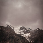
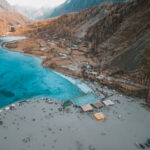
Gilgit-Baltistan boasts a unique landscape, unlike any other, covering an area of 72,971 square kilometers. The region’s mountains can be roughly classified into four major ranges. To the west, along the border with Afghanistan, lies the Hindu Kush range, which extends eastward to the Ishkoman Valley in Ghizer. The Ishkoman River divides the Hindu Kush from the Karakoram, the main mountain range of the region. The Karakoram stretches from the Ishkoman Valley to the northeast, bordering China. Further north, where the Hindu Kush and Karakoram meet, are the Pamirs, which form a border with Afghanistan and extend into Tajikistan and Kyrgyzstan. To the southeast, separated from the Karakoram by the River Indus, lies the western tip of the Himalayas. Near Alam Bridge, just before Gilgit, the three mightiest mountain ranges of the world—the Karakoram, Himalayas, and Hindu Kush—meet at a single point.The Himalayas and Karakoram are among the youngest mountain ranges in the world. Around 100 million years ago, the Indian plate began drifting northward, moving away from the African plate. About 55 million years ago, it collided with the Eurasian plate, giving rise to these towering, pristine mountains. This tectonic shift continues today, causing the mountains to rise each year. Gilgit-Baltistan is home to the largest glaciers outside the polar regions, often referred to as “the water tower of mankind.” These glaciers, covered in debris and rocks, are crucial for their survival, and without this protection, such vast glaciers would not exist. The Indus River enters Baltistan from Ladakh, where it is joined by numerous tributaries and rivers along its path, continuing its journey to the Arabian Sea and ranking as the third-longest river in Asia.
FLORA
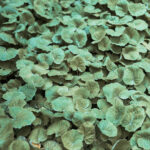
Gilgit-Baltistan is home to many endangered plant species, many of which have significant medicinal value. Between 2,000 and 3,000 meters in altitude, coniferous forests thrive with Himalayan blue pine (Pinus wallichiana), silver fir (Abies pindrow), and spruce (Picea smithiana). From 3,000 to 4,000 meters, you can find junipers, willows, and Himalayan birch. In some valleys between these elevations, Himalayan cedar also appears. Beyond 4,000 meters, the tree line gives way to alpine meadows, where a wide variety of medicinal herbs and vibrant flowers, including the magenta alpine primrose,
FAUNA
Gilgit-Baltistan is home to many endangered species, with conservation efforts in place, including national parks and hunting bans. Large mammals like the elusive snow leopard are increasingly difficult to spot in protected areas such as Naltar Valley, Khunjerab, and Qurumbar National Parks. The region hosts the world's largest population of snow leopards and has seen a decline in the markhor, which now inhabits more remote areas. Other endangered species include the Himalayan ibex, Marco Polo sheep, and blue bharal. The region also hosts golden marmots, Tibetan red wolves, and occasionally bears. Over 200,000 migratory birds visit between September and April.
CLIMATE
Gilgit-Baltistan's climate is mostly unaffected by the monsoon, except in southern Nanga Parbat. The high mountains block monsoon clouds, limiting rainfall in areas like Hunza, Skardu, and Gilgit. Gilgit receives about 130 mm of rain annually, mostly from March to May, while Skardu gets 110 mm from January to May. Above 5,000 meters, precipitation exceeds 1,000 mm. Global climate change has impacted the region, affecting glaciers, snowfall patterns, and increasing flood risks due to faster melting. More rain and delayed fruit blooming are also straining local ecosystems and agriculture. Protective measures are being taken, but stronger actions are needed to mitigate these effects.
LANGUAGES
Urdu, the national language of Pakistan, is widely spoken across Gilgit-Baltistan and serves as a common medium of communication between different communities. English is commonly understood by the youth, hotel managers, and guides. Although the official language has shifted from English to Urdu, many businesses, banks, and organizations still use English. Gilgit-Baltistan is home to around ten languages, including Balti (Baltistan), Brushuski (Yasin, Hunza, Nagar), Shina (Diamer, Gilgit town, and parts of Baltistan), Khowar (Ishkoman, Yasin, Upper Ghizer), Wakhi (Upper Hunza), and Gujari (spoken by nomads).
Explore More About Gilgit-Baltistan
Government
Promote sustainable tourism by conserving the area's natural and cultural heritage .
Local customs
Local customs in this area are deeply rooted in tradition and hospitality.
Getting Around
Visitors can choose from local buses, taxis, and ride-sharing services for convenient travel.
Visa and Licenses
Travelers may need a visa, depending on nationality, which can be applied for at the nearest embassy. Locals looking to operate hotels or offer activities like trekking must obtain the necessary permits and licenses from local authorities. These licenses ensure safety, regulation, and environmental protection. Contact for more details and inquiries